Forlì 1927-2017: model avenue over 90 years
by Fondazione NeriThe town of Forlì was predominantly an agricultural centre up until the start of the twentieth century. From the 1920s, it underwent a series of changes brought about by the fascist regime to turn it into one of the locations selected for testing a new urban policy. Mussolini himself imposed a programme of major public works, as well as development of production activities. The reorganisation plan provided for various projects aimed at proper development and restructuring of the entire road system. New districts were constructed along the southern section of the Via Emilia from which a new main road ran perpendicular to the railway station, which was to become home to various town services (schools, sports facilities, and administrative and business offices).
The decision to connect the railway station to Piazzale della Vittoria and consequently the adjacent public gardens via an 800m-long tree-lined avenue was made in 1926 and was brought to completion the following year by engineers Luigi Donzelli and Pietro Marconi. The new road, named Viale Benito Mussolini (today Viale della Libertà) was planned to be monumental in size, spanning a total width of 40 metres. The mayoral resolution of 28 December 1926 states that “the road consists of a 12.5m-wide central carriageway, flanked by two raised tree-lined walkways, each 6.25m wide, separating another two 5m-wide side roads which are also suitable for vehicles. Finally, there are two further 2.5m-wide pavements running along the outer sides of the road”.
The pavements had natural stone kerbs with asphalt surfaces and 34 granite seats adapted to the edges of the pavement with concrete bases for support at the sides. Each road had two lines of trees (holm oaks), comprising 316 plants in total.
A particular feature was the lighting system giving a perceived sense of height and continuity equal to or superior to the trees. The shape of the posts, featuring an elegant curved design, broke away from the geometric style of the rest of the road: a hangover from the previous Art Nouveau style. Initially, lighting was provided by suspended lamps supported by posts in the central section, and streetlamps at the sides. In both cases, the tubular iron posts had cast iron bases decorated with protruding parallel vertical motifs bearing the fascist crest and the date of installation (1927). Later, in the mid-1930s, the suspended lights in the central section were replaced by posts adorned with the same distinctive symbol.
Thanks to specific technical and aesthetic methods, the avenue leading to the railway station became the city’s main thoroughfare and one of the largest roads in Italy. The “Viale all’Italiana” quickly became the ideal location for hosting majestic ceremonies including military and sporting parades.
Its uniqueness led to it becoming a model for other projects during the period. There are three significant urban projects in Rome worth noting, which incorporated Forlì’s road plan and lighting engineering project: Via dei Fori Imperiali, Via della Conciliazione and, in particular, Via Imperiale (now Via Cristoforo Colombo) which links the city centre to the coast, leading from EUR, the district intended to host the 1942 Esposizione Universale di Roma which never took place due to the outbreak of World War II.
-
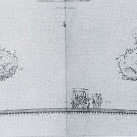
- Sezione trasversale del viale Benito Mussolini, 1926
-
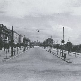
- Viale con illuminazione ancora a sospensione centrale, Foto Zoli 1932
-
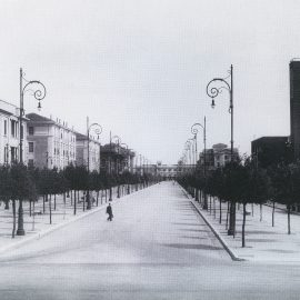
- Il
-

- Viale della Libertà, particolare della carreggiata laterale

-
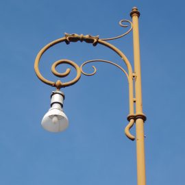
- Dettaglio dei pali ancora oggi installati in piazza Duomo e in via delle Torri
