“The illuminated road”: a route along the Marches section of the Via Flaminia
by Fondazione NeriIn ancient times the Flaminia represented the main road route for links between Rome and northern Italy and, subsequently, central and eastern Europe. Opened by the consul Gaius Flaminius around 220 BC, it rose up along the valley of the Tiber as far as the Apennines and through the advantageous Scheggia pass in Umbria (630 metres) and then descended on the Adriatic side along the Metauro valley as far as Fanum Fortunae (Fano). From there it continued through Pisaurum (Pesaro) and reached Ariminum (Rimini) with a route parallel to the coast.
Still today the road constitutes, above all in the Marches section in the province of Pesaro and Urbino, a true unicum due to the presence of bridges, tunnels, cuts in the rock, boundary stones and inscriptions.
All this in addition to the residential areas created along the route, many of which, from simple resting stations (mansiones), have become over the centuries important towns, holders of a rich heritage of history, architecture and nature.
The pictures that follow, accompanied by short captions, are dedicated in fact to some of these places and show their main piazzas and streets in a much more recent age, the first half of the twentieth century, when electric light had already replaced the gas type almost everywhere and powerful lampposts, often with several lights, were able to light up large sections of the “great road” from Rome.
-
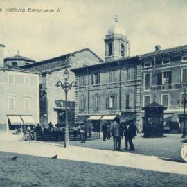
- Cagli (PU), view of piazza Vittorio Emanuele II with the elegant candelabras for public lighting with 4 lights

-
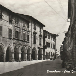
- Fossombrone (PU), Corso Garibaldi, the lighting of the street was ensured by large lamps hanging in the centre of the roadway, supported by taut cables attached to the walls of the buildings

-
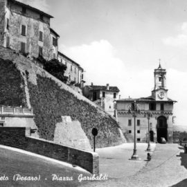
- Cartoceto (PU), a pair of candelabras in piazza Garibaldi

-
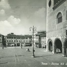
- Fano, piazza XX Settembre, lampposts cast by Compagnia Brunt in the early twentieth century
